


What are the delivery costs?
We offer Free UK Mainland Delivery on all orders over £20. Products shipped to outlying UK regions are excluded from free shipping.
Standard delivery is normally 2 - 5 working days.
Please view our delivery page for full information on UK and international delivery costs.
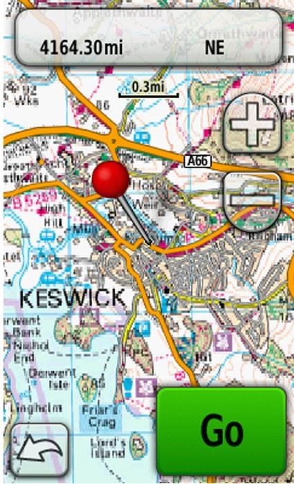
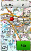
Garmins revolutionary new maps bring outdoor enthusiasts the opportunity to view highly detailed mapping from the Ordnance Survey Explorer map series, whilst navigating with turn-by-turn accuracy
Occasionally, without notice, manufacturers change product design and/or specifications.
- Garmins new topographic maps allow users of the Oregon and Colorado handhelds to experience using raster mapping with the intelligence of vector cartography, giving navigation with ease and accuracy
- Garmins new mapping offers all the benefits of traditional paper maps including boundary identification and public rights of way, with the added bonus of navigational directions, points of interest and the numerous other facilities that Garmin users have come to expect from their handheld GPS systems
- It is simple to add Ordnance Survey Mapping to your Garmin Oregon or Colorado handheld
- With rights of way, fences, permitted paths, contour and bridleways, discover new destinations and geographic references on foot, bike or in the car
- Garmin topographic maps add even more points of interest to your Garmin, such as cafes, hotels, campsites, information areas and train stations
Occasionally, without notice, manufacturers change product design and/or specifications.
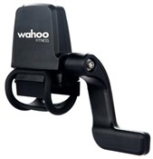
Garmin Discoverer Topographical Mapping
OPTIONS
DESCRIPTION
DELIVERY
SIMILAR PRODUCTS
SEE ALL


OTHER CUSTOMERS BOUGHT
SEE ALL